
Services
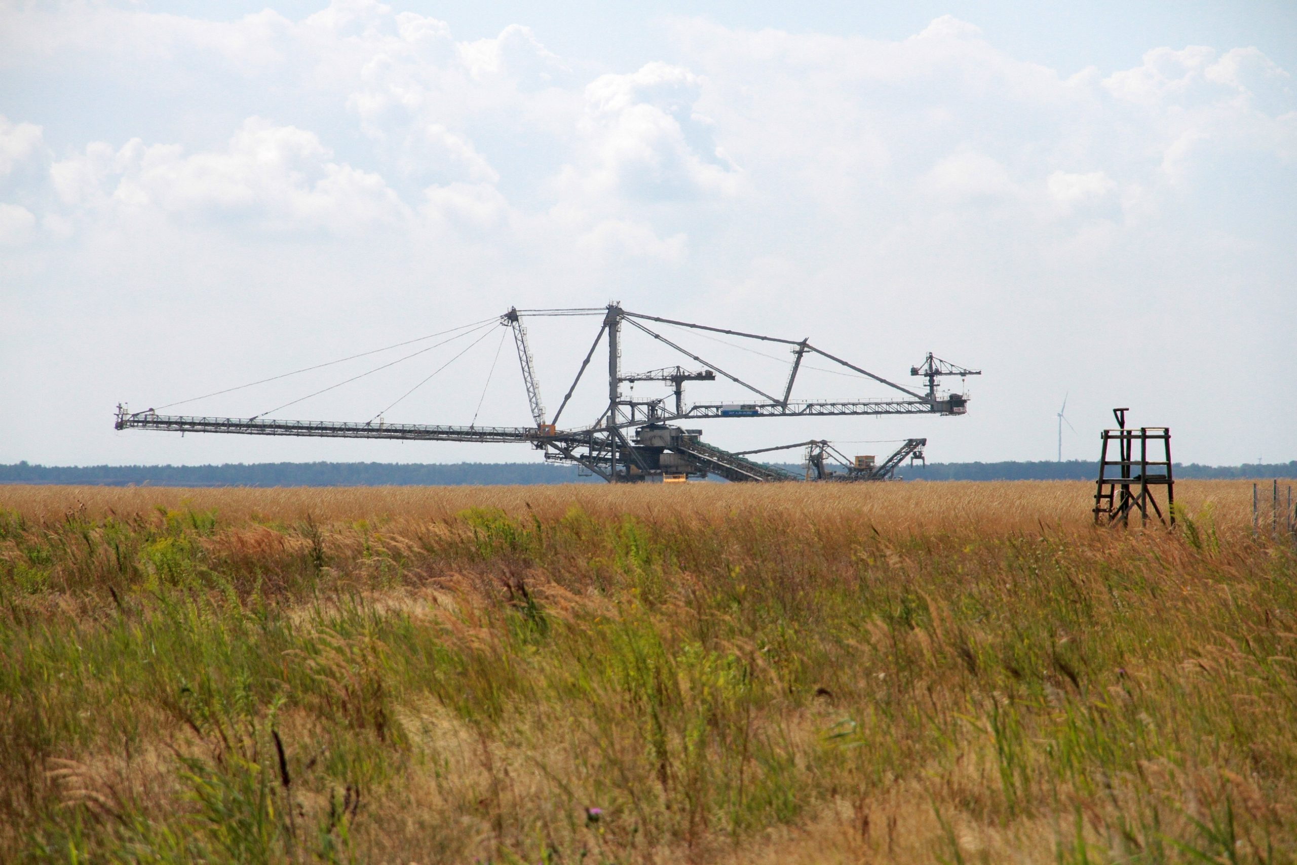
Backing of mine rehabilitation
The central concern of the FIB e.V. is the recultivation of landscapes devastated by raw material extraction. To this end, we advise mining companies, accompany monitoring programmes for soil and yield development and, on this basis, develop adapted management and fertilisation recommendations for the forestry and agricultural sectors.
Contact:
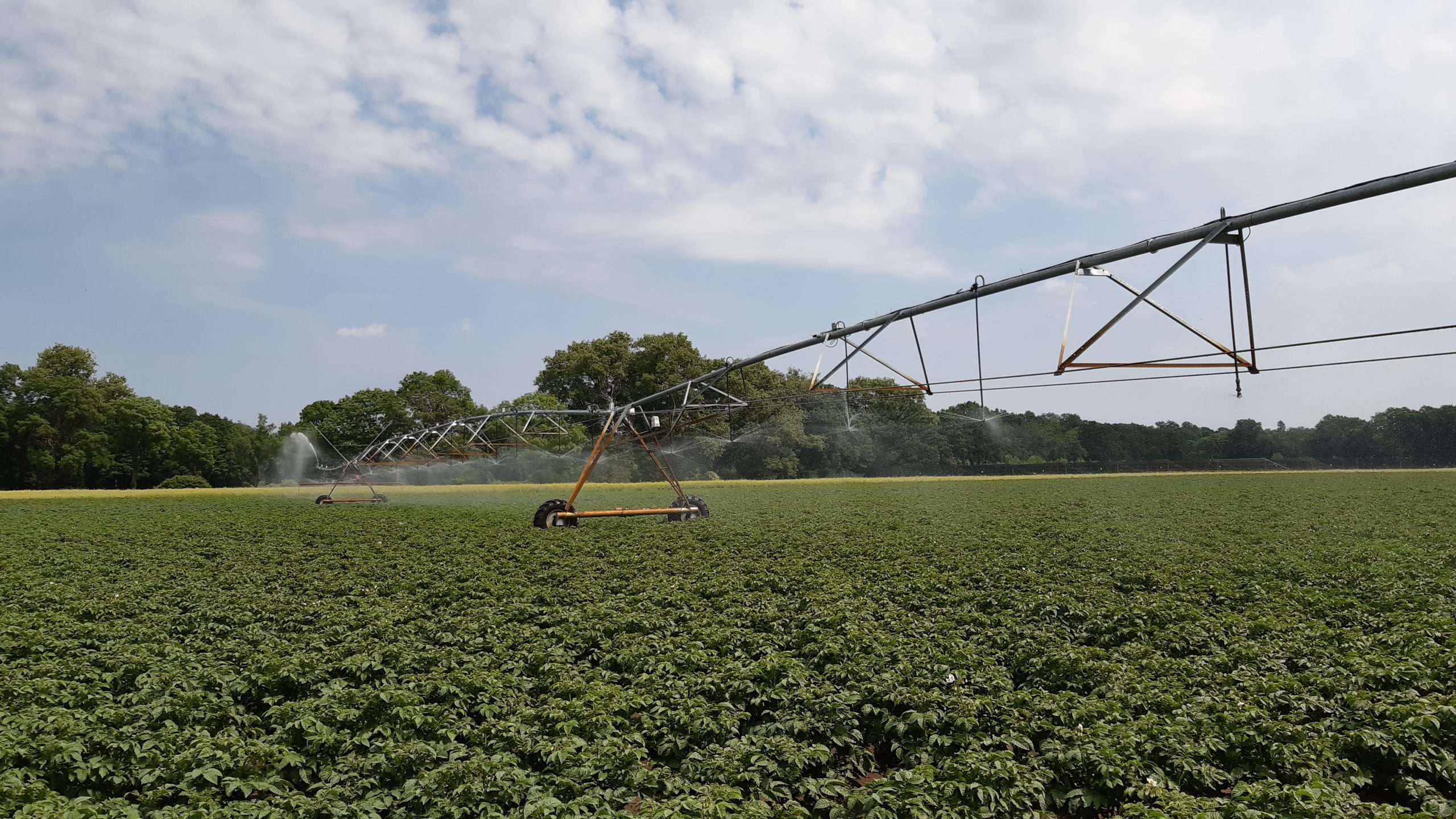
Irrigation consulting
Irrigation stabilises crop growth, yield and quality, especially in dry periods, and extends crop rotation options in marginal locations. In addition to the technical requirements, a needs-based and resource-saving use of supplementary water is decisive for their economic success. Our IRRIGAMA steering system enables irrigation farmers to control irrigation on a per-crop and part-crop basis, taking into account plant development, soil moisture and current weather forecasts.
Contact:
Dr. Anne RADEMACHER, Rainer Schlepphorst, Dr. Beate ZIMMERMANN
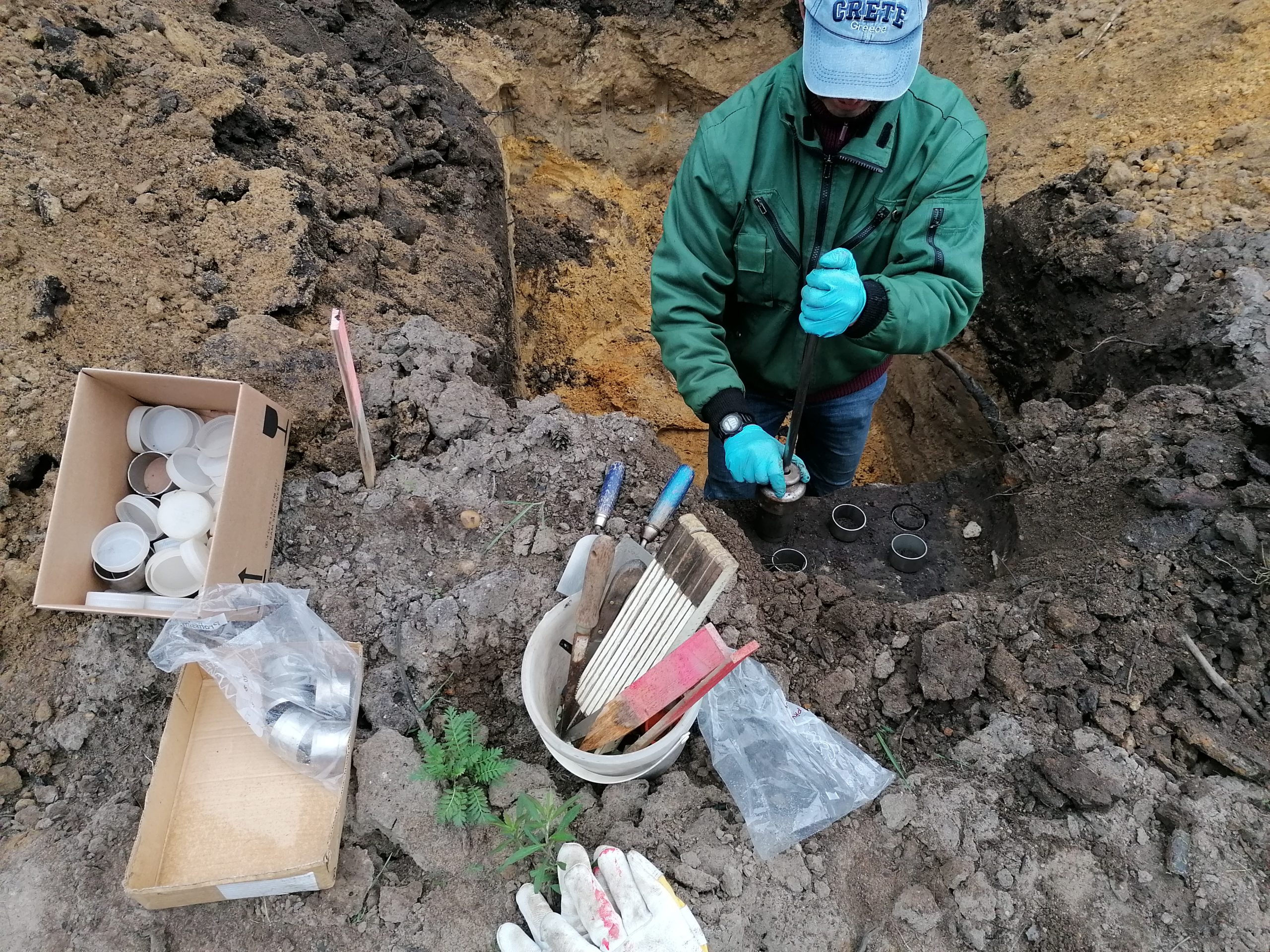
Soil mapping
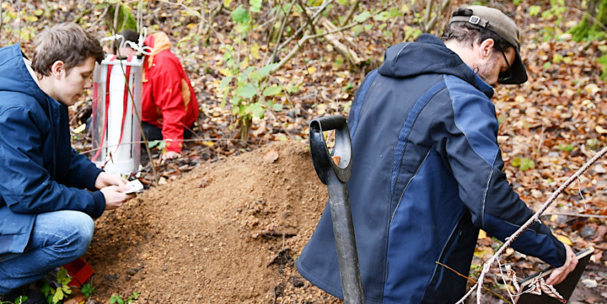
We carry out extensive drill stock mapping in order to prepare expert reports and to derive recultivation recommendations for agricultural and forestry soils of active and rehabilitated open-cast mines. This also includes the exploration and the addressing of soil profiles in accordance with Soil Science Mapping Instructions 5.
Contact:
Soil science construction supervision
In the context of construction projects, harmful soil changes must be avoided and the natural soil functions must be maintained or restored. We provide expert support during the planning, approval and construction phases and take over both the planning and the control of measures for soil protection and recultivation.
Contact:
GIS
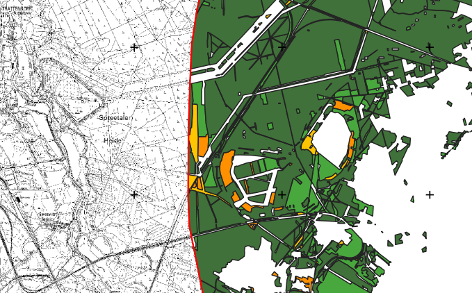
In addition to the precise documentation and cartographic evaluation of floristic and faunistic mapping, we also use geoinformation systems for the planning of experimental areas and for the presentation and analysis of environmental data. We work with ArcGIS, QGIS, GRASS GIS and R software. With the help of our large format plotter we can also produce analogue maps up to A0 format.
Contact:
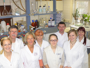
Lab analyses
Our accredited research laboratory offers physical, physico-chemical and selected chemical analyses of soils, plants, sludges, water and wastewater as well as the sampling of wastewater for small wastewater treatment plants. A representative selection of processes from our range of services and an overview of our technical equipment can be found here
Contact:
Landscape planning and impact regulation
The interests of species protection must be examined in all planning and licensing procedures requiring approval. On the basis of the biological expert mapping, we prepare nature conservation expert reports (species protection expert contributions), particularly in the course of the remediation planning of the Lusatian mining areas. Furthermore, we offer ecological construction supervision for a wide range of construction projects. This is a continuous ecological accompaniment and coordination of the construction measure, which includes regular monitoring with verification of compliance with nature conservation regulations and recording of the inspections.
Contact: Friederike KLEINSCHMIDT
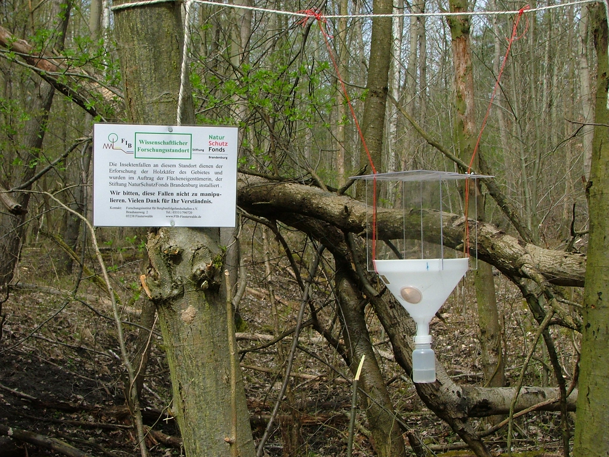
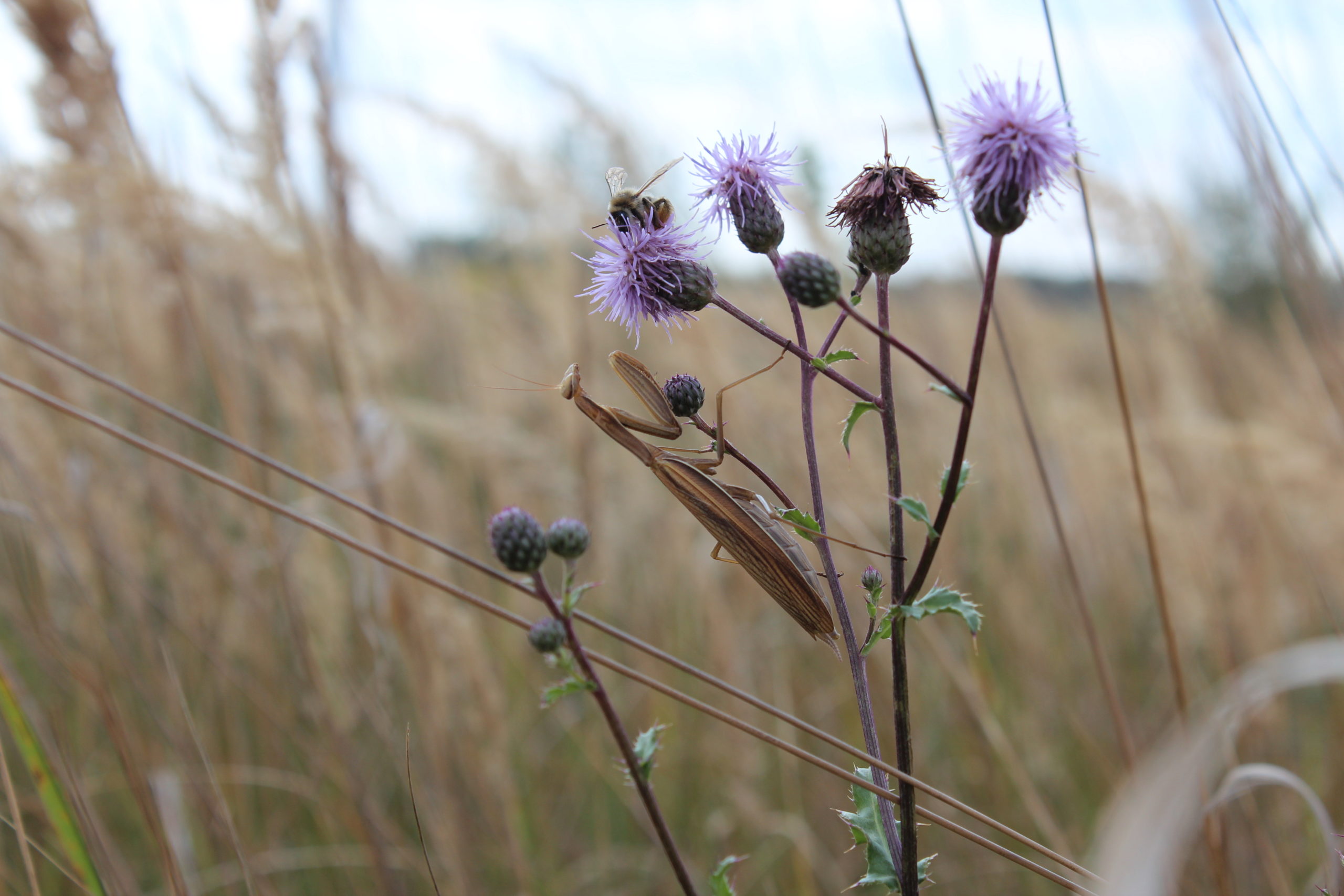
Ecological mapping
Due to many years of experience, we have both the necessary floristic and faunistic knowledge of species as well as extensive expertise regarding the occurrence and life style of the species. Our experience in recording and evaluation includes
- plants, vegetation communities and biotopes
- Birds
- Reptiles and amphibians
- water beetles, water bugs, dragonflies and caddis flies
- day and night moths, ground beetles and grasshoppers
Contact: Ingmar LANDECK
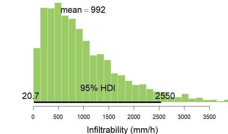
Statistical data analysis
With the help of the freely available software R we statistically evaluate environmental data. Besides variance and regression analyses, geostatistical methods are part of our repertoire. We have practical experience in both orthodox and Bayesian statistics.
Contact: Dr. Beate Zimmermann
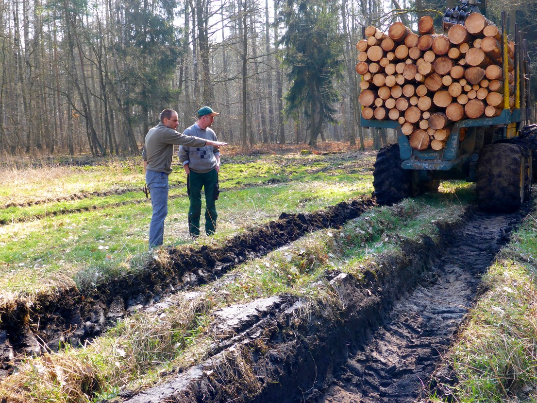
Technology assessment of forestry technology
Using our standardised set of methods, we can comprehensively investigate the technical feasibility of various types of sites and provide scientifically sound parameters for the environmentally compatible use of machines in the forest. For this purpose, we combine easily measurable indicators for risk assessment and process optimisation with soil-physical field methods and laboratory analyses. High-precision 3D models of the soil surface, which are created by photogrammetric methods, additionally support the evaluation.
Contact: Dr. Raul Köhler
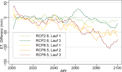
Water balance modelling
We use simulation tools such as Brook 90 and Bowahald to estimate the impact of land use and climate changes on the local water balance. We pay special attention to the collection and evaluation of the model input data. Automated input routines and result queries enable us to calculate even extensive scenarios.
Contact: Dr. Beate Zimmermann